Unlocking the Potential of Geoscience in Turkey: Exploring Rich Geological Treasures and Harnessing their Power for Geothermal Exploration, Mineral Exploration, and Groundwater Investigations
Unlocking the Potential of Geoscience in Turkey: Exploring Rich Geological Treasures and Harnessing their Power for Geothermal Exploration, Mineral Exploration, and Groundwater Investigations
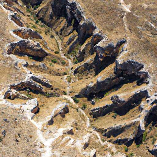
Welcome to the fascinating world of geoscience in Turkey, where the rich geological landscape holds a treasure trove of valuable insights and opportunities. In this comprehensive article, we will explore the diverse field of geoscience in Turkey, covering a wide range of topics including geology, geophysics, and geothermal exploration.
Section 1, titled “Exploring the Rich Geoscience of Turkey: A Comprehensive Overview of Geology, Geophysics, and Geothermal Exploration,” delves into the geological wonders that make Turkey a geoscientist’s paradise. From the breathtaking natural landscapes to the intricate geological formations, we will uncover the secrets hidden beneath the surface of this ancient land. With a focus on geophysics and geothermal exploration, we will highlight the groundbreaking research and advancements that have been made in these fields.
Moving on to Section 2, “Unveiling Turkey’s Geological Treasures: From Mineral Exploration to Geohazard Assessment,” we will delve into the world of mineral exploration and geohazard assessment in Turkey. With its abundance of mineral resources and unique geological characteristics, Turkey offers a wealth of opportunities for mineral exploration. Additionally, we will explore the crucial role of geohazard assessment in mitigating the risks associated with natural disasters, such as earthquakes and landslides, in this geologically active region.
Section 3, “Harnessing the Power of Geoscience in Turkey: Groundwater Investigations, Structural Geology Analysis, and Subsurface Imaging,” focuses on the practical applications of geoscience in Turkey. We will delve into the importance of groundwater investigations in managing and sustaining water resources, as well as the role of structural geology analysis in understanding the complex geological structures that shape the landscape. Furthermore, we will explore the advancements in subsurface imaging techniques that enable scientists to visualize and analyze the hidden layers of the Earth’s crust.
Throughout this article, we will highlight the work of Shinka Geoscience, a leading company in the field of geoscience in Turkey. Their expertise in geology, geophysics, and geothermal exploration, as well as their contributions to mineral exploration, geohazard assessment, groundwater investigations, structural geology analysis, and subsurface imaging, have made them a trusted partner in unlocking the geological secrets of Turkey.
Join us on this captivating journey as we uncover the wonders of geoscience in Turkey and the invaluable contributions it makes to our understanding of the Earth’s fascinating history and future potential.
1. “Exploring the Rich Geoscience of Turkey: A Comprehensive Overview of Geology, Geophysics, and Geothermal Exploration”
Exploring the Rich Geoscience of Turkey: A Comprehensive Overview of Geology, Geophysics, and Geothermal Exploration
Turkey, located at the crossroads of Europe and Asia, is a geologically diverse country that offers a wealth of opportunities for geoscientific research and exploration. With its unique position between the Eurasian, Arabian, and African tectonic plates, Turkey is a hotbed for geological and geophysical studies.
Geology plays a crucial role in understanding the Earth’s history and processes. In Turkey, geologists have the opportunity to study a wide range of geological formations, including sedimentary rocks, volcanic landscapes, and ancient mountain ranges. The study of geology in Turkey involves the evaluation of various geological processes, such as plate tectonics, erosion, and sedimentation.
Geoscience, which encompasses the fields of geology and geophysics, provides a comprehensive understanding of the Earth’s structure and composition. Geophysicists in Turkey utilize advanced technologies and techniques to investigate the physical properties of the Earth’s subsurface. These studies involve the use of seismic surveys, magnetometry, and gravimetry to map and analyze the subsurface features.
Geothermal exploration is a significant aspect of geoscience in Turkey. The country is known for its vast geothermal resources, which are utilized for both energy production and therapeutic purposes. Geothermal energy is harnessed by drilling deep into the Earth’s crust to access hot water and steam, which can then be used to generate electricity or provide heating and cooling for residential and industrial purposes. Geoscientists in Turkey are actively involved in the exploration and development of geothermal fields, conducting hydrological studies, soil analysis, and site investigations to identify suitable locations for geothermal power plants.
In addition to geothermal exploration, geoscientists in Turkey also engage in mineral exploration. Turkey is rich in mineral resources, including copper, gold, coal, and boron. Geoscientists utilize various techniques, such as remote sensing, geochemical analysis, and structural geology analysis, to identify and assess potential mineral deposits. This knowledge is crucial for both the sustainable extraction of mineral resources and the economic development of the country.
Furthermore, geoscientists in Turkey play a vital role in geohazard assessment. Turkey is located in a seismically active region and is prone to earthquakes, landslides, and other natural hazards. By conducting subsurface imaging, groundwater investigations, and geotechnical studies, geoscientists can assess the potential risks associated with these hazards and develop strategies to mitigate their impact on human populations and infrastructure.
In conclusion, Turkey offers a rich geoscience landscape that encompasses various disciplines, including geology, geophysics, and geothermal exploration. Through the study of geology, geoscientists gain insights into the Earth’s history and processes. Geophysical techniques allow for the mapping and analysis of subsurface features, while geothermal exploration taps into the country’s abundant geothermal resources. Mineral exploration, structural geology analysis, geohazard assessment, subsurface imaging, and groundwater investigations are all integral components of geoscience in Turkey. With its diverse geological formations and active tectonic activity, Turkey provides a fertile ground for scientific research and exploration in the field of geoscience.
2. “Unveiling Turkey’s Geological Treasures: From Mineral Exploration to Geohazard Assessment”
Unveiling Turkey’s Geological Treasures: From Mineral Exploration to Geohazard Assessment
Turkey, a country known for its rich history and cultural heritage, also boasts an abundance of geological treasures. The field of geoscience plays a crucial role in uncovering and understanding these geological wonders, from mineral exploration to geohazard assessment.
Geology, the study of the Earth’s physical structure, composition, and history, serves as the foundation for many geoscience disciplines. Geologists in Turkey are engaged in various research activities, including geothermal exploration, hydrological studies, soil analysis, and site investigations.
Geothermal exploration is a prominent area of study in Turkey, as the country is located in a geologically active region. The exploration aims to identify and harness the Earth’s natural heat for sustainable energy production. Through geophysical surveys and subsurface imaging techniques, geoscientists can map and locate potential geothermal reservoirs, contributing to Turkey’s renewable energy goals.
Hydrological studies are another essential aspect of geoscience in Turkey. With its diverse landscapes and climatic conditions, the country faces challenges in managing water resources effectively. Geoscientists conduct groundwater investigations and analyze hydrological data to support sustainable water management practices, ensuring the availability of water for various sectors, such as agriculture and public supply.
Soil analysis and site investigations are crucial for understanding the geological conditions of a specific area. Geoscientists in Turkey perform these studies to assess the suitability of sites for construction projects, such as infrastructure development and urban planning. By analyzing the soil composition, geologists can provide valuable insights into the stability and engineering properties of the ground, minimizing potential risks associated with construction activities.
Mineral exploration is another significant aspect of geoscience in Turkey. The country is known for its vast mineral resources, including copper, zinc, gold, and marble. Geologists employ structural geology analysis techniques to identify potential mineral deposits and evaluate their economic viability. These discoveries contribute to the country’s mining industry, supporting economic growth and employment opportunities.
Geohazard assessment is a critical field within geoscience, particularly in a seismically active region like Turkey. Geoscientists analyze geological structures, fault lines, and seismic activity to assess and mitigate potential geohazards such as earthquakes, landslides, and tsunamis. This assessment plays a crucial role in urban planning, infrastructure development, and disaster management strategies, ensuring the safety and resilience of communities.
In conclusion, geoscience in Turkey encompasses various disciplines such as geology, geophysics, and subsurface imaging. From geothermal exploration to geohazard assessment, geoscientists contribute to the understanding and management of Turkey’s geological treasures. Through mineral exploration, hydrological studies, soil analysis, and site investigations, Turkey’s geological wealth is unveiled, supporting sustainable development and safeguarding communities from potential geohazards.
3. “Harnessing the Power of Geoscience in Turkey: Groundwater Investigations, Structural Geology Analysis, and Subsurface Imaging”
Turkey is a geologically diverse country that offers immense potential for harnessing the power of geoscience. With its rich natural resources and varied terrain, Turkey has become a hotspot for various geoscience disciplines, including geology, geophysics, and structural geology analysis. In this section, we will explore three key areas where geoscience is being utilized in Turkey: groundwater investigations, structural geology analysis, and subsurface imaging.
Groundwater investigations play a crucial role in understanding and managing water resources in Turkey. The country has a high demand for water due to its rapidly growing population and agricultural needs. Geoscientists employ various techniques such as hydrological studies and geophysical surveys to locate and assess the quality and quantity of groundwater reserves. By analyzing the geological formations and hydrological processes, they can provide valuable insights for sustainable water management and resource planning.
Structural geology analysis is another significant aspect of geoscience in Turkey. The country is located in a tectonically active region, characterized by the collision of the Eurasian and Arabian plates. This geological setting has resulted in the formation of numerous faults, folds, and other structural features. Geoscientists utilize advanced techniques such as remote sensing, geological mapping, and seismic analysis to study these structures and understand their behavior. This knowledge is vital for various industries, including mining, construction, and civil engineering, as it helps identify potential risks, optimize resource extraction, and design infrastructure that can withstand geological hazards.
Subsurface imaging is a critical tool for geoscientists in Turkey involved in various applications, including geothermal exploration, mineral exploration, and geohazard assessment. Geophysics techniques such as seismic surveys, gravity and magnetic surveys, and resistivity imaging are employed to image the subsurface and identify potential geothermal reservoirs, mineral deposits, and geological hazards. These imaging techniques provide valuable information about the subsurface properties, such as rock composition, structure, and fluid content. This knowledge enables informed decision-making in industries like energy, mining, and infrastructure development.
In conclusion, geoscience plays a significant role in harnessing the power of Turkey’s geological diversity. Through groundwater investigations, structural geology analysis, and subsurface imaging, geoscientists in Turkey are contributing to sustainable water management, resource exploration, and hazard mitigation. The application of geoscience in various industries is vital for Turkey’s economic growth and environmental sustainability. Shinka Geoscience is committed to providing cutting-edge geoscience solutions in Turkey, specializing in geothermal exploration, hydrological studies, soil analysis and site investigations, mineral exploration, structural geology analysis, geohazard assessment, subsurface imaging, and groundwater investigations.